The Cassowary Coast is one of the wettest places in Australia. Tully — just 15 minutes inland from Mission Beach — is consistently ranked among the highest rainfall towns in the country, and the wet season (November to April) brings the kind of rain that can close roads, flood rivers, and fundamentally change the landscape overnight.
That’s not a reason to avoid the region during the wet season. The waterfalls are at their most spectacular, the rainforest is intensely green, and the crowds thin out considerably. But it is a reason to travel with good information. In 2026, Cassowary Coast Regional Council has improved the tools available to do exactly that — including live flood sensors on the regional disaster dashboard.
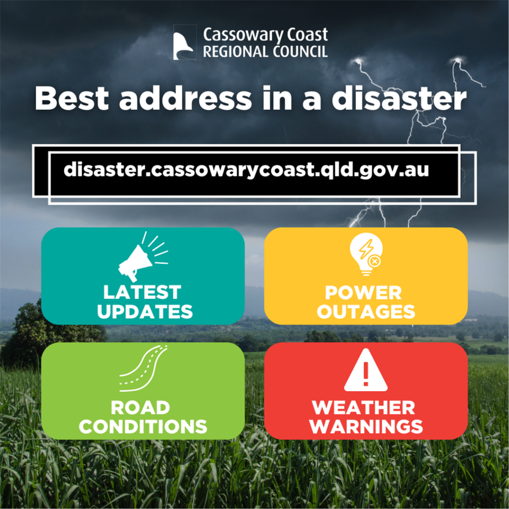
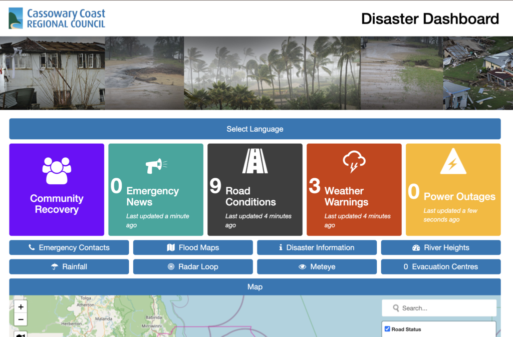
The Cassowary Coast Disaster Dashboard
Cassowary Coast Regional Council has introduced live flood sensors into its regional disaster management dashboard, giving residents and visitors real-time data on water levels across the region’s rivers and flood-prone areas.
For visitors, the practical application is straightforward: before driving a road that passes through low-lying areas or over bridges after heavy rain, you can check whether conditions are safe. This is particularly relevant for accessing Mission Beach from the Bruce Highway, and for travel in the Tully and Cardwell corridors.
Real-Time Road and Bridge Alerts
In addition to flood sensor data, the dashboard provides updates on road and bridge conditions across the region. The practical advice for wet season visitors is to check the dashboard before setting out on any drive that involves low-lying roads, creek crossings, or bridges — particularly after a night of heavy rain.
How to Check Road Conditions Before You Drive
- Visit the Cassowary Coast Regional Council disaster dashboard at ccrc.qld.gov.au
- Check Queensland Traffic at qldtraffic.qld.gov.au for broader road alerts
- Ask at your accommodation — local operators typically know current road status
Wet Season Driving on the Cassowary Coast
Key Principles
- Never drive through floodwater. Even shallow-looking water can conceal damage, strong current, or dangerous depth.
- Check road conditions before leaving, not after you’re already en route.
- Carry water and supplies in case you are delayed.
- Allow extra time for all journeys during and after heavy rain.
- Watch for debris on roads after storms — branches, fallen trees, and mud are common.
Cassowary Safety: Year-Round Responsibility
One of the Cassowary Coast’s most distinctive residents is the southern cassowary — a large, flightless bird that is both endangered and genuinely formidable. The region has one of the highest densities of cassowaries in Australia, and encounters are relatively common on rainforest roads around Mission Beach and the hinterland.
How to Stay Safe Around Cassowaries
- Do not approach or attempt to feed cassowaries. Fed cassowaries can become aggressive, and feeding is illegal.
- Slow down on rainforest roads, particularly at dawn and dusk when cassowaries are most active.
- Keep dogs on leads in cassowary habitat.
- If a cassowary approaches you, back away slowly without turning your back on it. Do not run.
Stinger Season: Swimming Safety November to May
Marine stingers — including box jellyfish and Irukandji — are present in the waters of the Cassowary Coast between November and May. This does not mean you cannot swim, but it does mean you need to swim smart.
Stinger Season Swimming Rules
- Swim only in designated stinger enclosures at patrolled beaches.
- Wear a stinger suit if you are snorkelling or swimming outside the enclosures.
- Vinegar stations are positioned at beaches throughout the region.
- Seek immediate medical attention for any suspected jellyfish sting.
Responsible Tourism: Protecting the Cassowary Coast
- Use reef-safe sunscreen when swimming, snorkelling, or diving.
- Do not remove or damage coral.
- Dispose of rubbish properly — litter in the rainforest and on beaches harms wildlife.
- Leave camping areas as you found them, or better.
Useful Resources
- Cassowary Coast Regional Council
- Queensland Traffic (road conditions)
- Bureau of Meteorology (local forecasts)
- Queensland Parks and Wildlife Service
Frequently Asked Questions
What is the Cassowary Coast wet season?
The wet season runs from approximately November to April. Tully averages around 4,000mm of rain per year, making it one of the wettest towns in Australia. The wet season brings spectacular waterfalls and vivid green rainforest, but also the potential for road closures and flooding.
Is it safe to visit the Cassowary Coast in the wet season?
Yes, with appropriate planning. Check road conditions before travelling, swim only in stinger enclosures during stinger season (November–May), and monitor the Cassowary Coast Regional Council’s disaster dashboard for real-time alerts.
Are cassowaries dangerous?
Cassowaries are large, powerful birds that can be dangerous if approached, cornered, or fed. Keep your distance, do not feed them, keep dogs on leads, and slow down on rainforest roads — particularly at dawn and dusk.
Travel Smart, Stay Safe, Enjoy the Tropics
The Cassowary Coast’s wet season is not something to fear — it’s something to understand. With live flood data now available through the regional disaster dashboard, and clear guidelines for stinger season and cassowary safety, the information you need to travel confidently is readily accessible.
Come prepared, stay informed, and the Cassowary Coast will reward you with experiences that the dry-season-only visitor rarely gets to see.